Article & Photos By David Yadock
Dry Gulch & Western, Update 7
All of you that were able to see my Zoom layout tour on September 11th will know what this update is all about. I will go over some of the subtle changes that are in and around the Potter Flats/Raade Springs area. Some more scenery was added along the mainline. Trees were planted and Raade Springs was completed. That scene was finally joined in with all the other areas. The last piece of the puzzle is the Dry Gulch access hatch, you may see it hovering up in the air in some of these photos. That access hatch has been a slow work in progress but once completed it will allow the scenery to be finished off in the Dry Gulch peninsula area.
Photo 34 shows what Raade Springs, and the surrounding area looked like prior to adding scenery. I only had a small station placed in the town. The branch line that serviced Raade Springs was never really operational and most of the track was buried in tunnels. This was not good for operational capabilities, so this area was never fully developed. A remedy for the buried track was needed if I was to apply scenery to the entire area. The track to Raade Springs was relocated and now most of the track is no longer in tunnels.
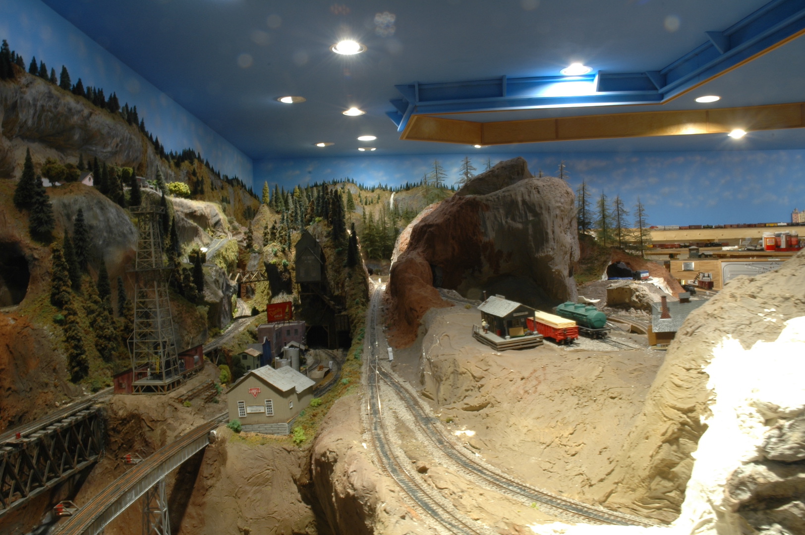
Photo 35 is a nice view looking down the mainline that also serves as a branch line to Raade Springs. Potter Flats is on the left while Raade Springs is toward the right. The large yellow barn-like building on the right is a coal pocket that is accessible via the town of Wapwallopen on the branch line. A nice stand of trees has been planted to act as a view block.
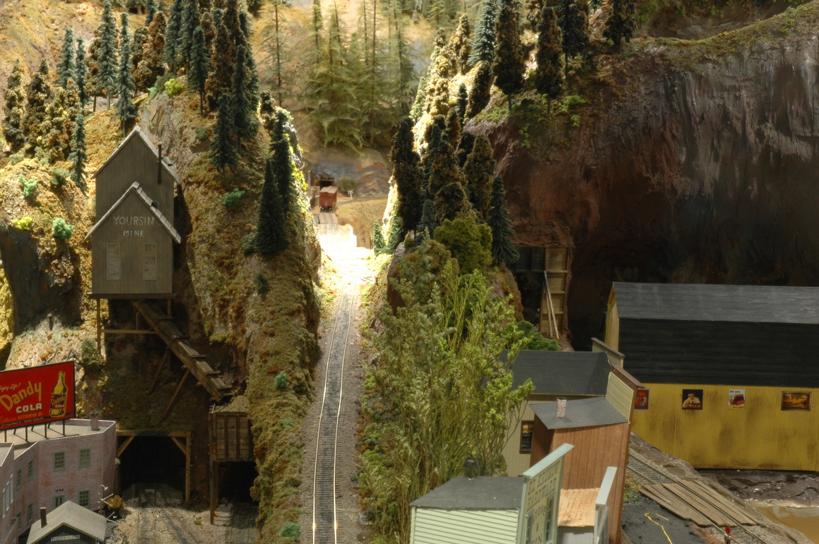
Photo 36 Raade Springs is a small hamlet served by the branch line. It has two mining operations. The Cantby mine and the Higotta mine are both located on one side of the town. The Higotta mine ore bin is placed on the combination branch line and siding. This siding leads directly into Dry Gulch through a short tunnel just out of the picture by the ore bin. This becomes a dual-purpose track for either branch line or siding use during operating sessions.
Since Raade Springs is placed on a very narrow strip of real estate I cantilevered three structures so that they hang off a short cliff. This allowed me to place the buildings in front of a small road. The rest of the area was built up and many wooden retaining walls are placed in the area. This gives the location a mining town charm. You can see the main support for the Dry Gulch access hatch just above the ore bin.
Photo 37 Here you can see how small an area Raade Springs occupies. To the right is Higotta mine and its ore bin. In the photo at the top right is Cantby mine. To the left of A. Oster supplies is the vertical support for the Dry Gulch access hatch.
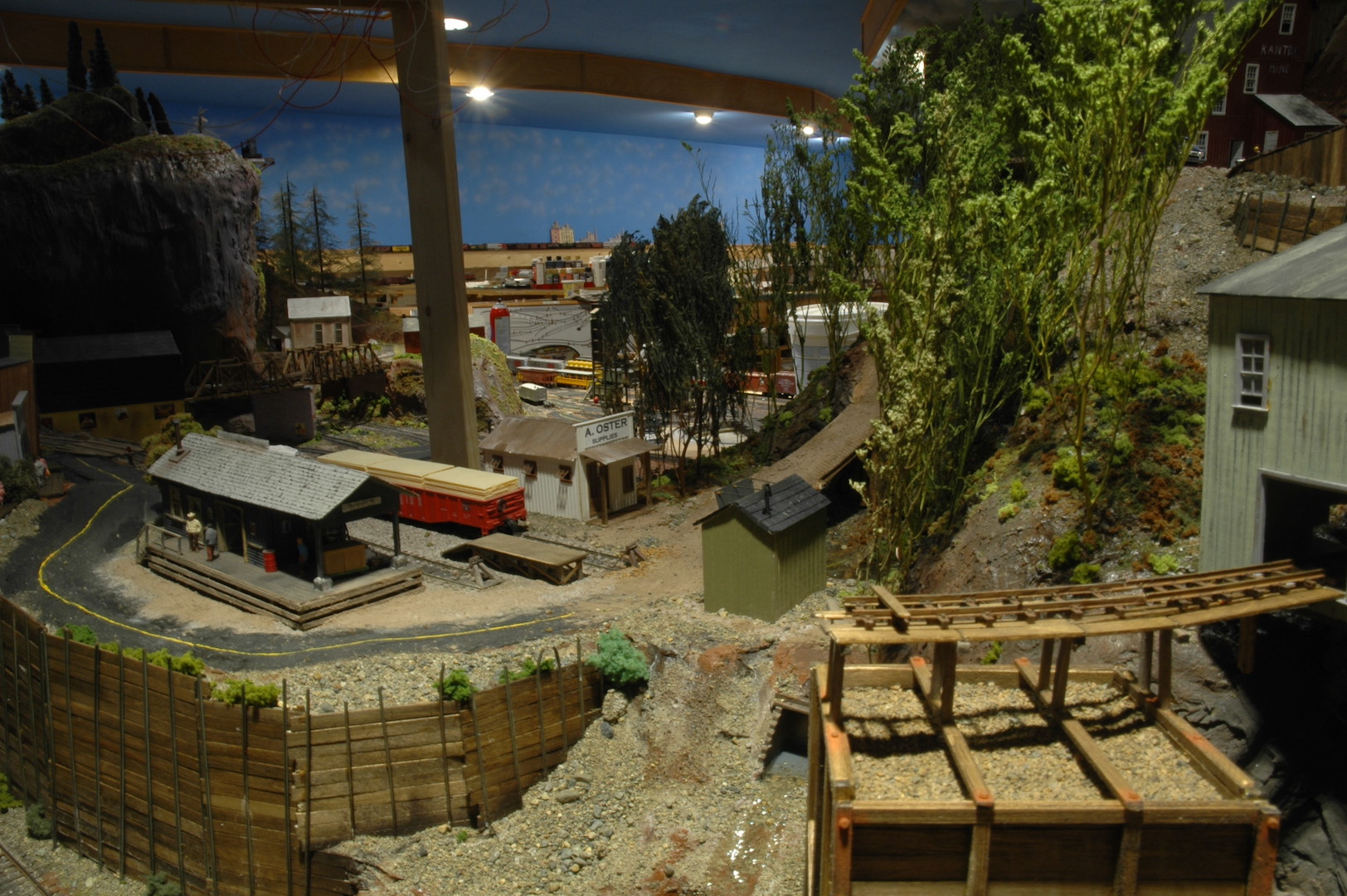
Photo 38 Cantby mine is next to Higotta mine and features a forest the was logged off years ago to supply wood for the mine. Opportunistic trees have taken over where the forest was cleared.
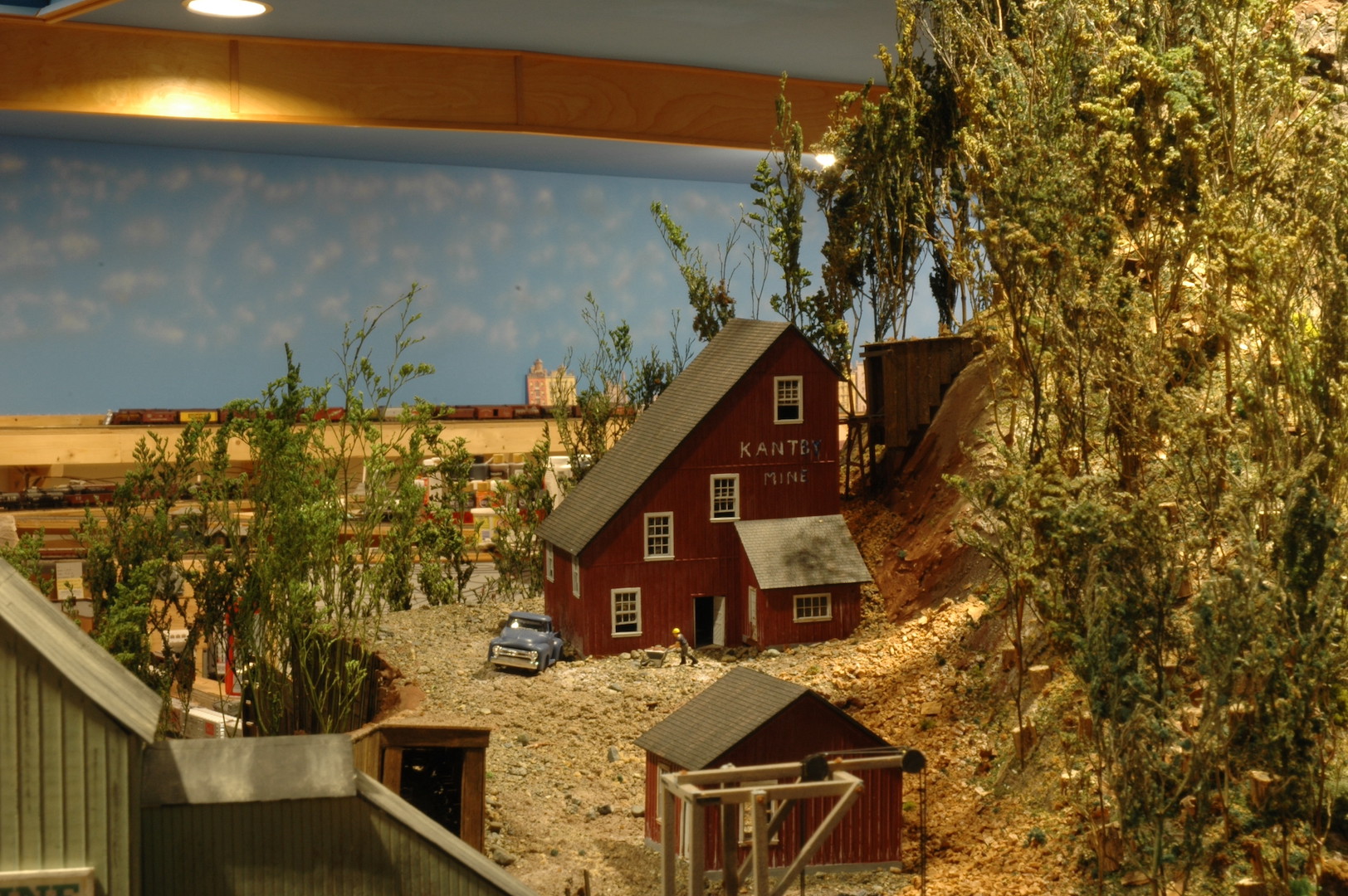
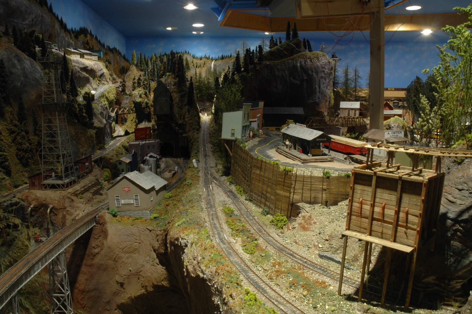
Photo 39 Give a clear view of Higotta mine with Cantby mine in the background. You can also see the many wooden retaining walls placed in the area. Floating in the top left portion of the photo is the Dry Gulch access hatch! This hatch gives me complete access to Potter Flats, Raade Springs, a good portion of Wapwallopen, and the backside of Dry Gulch.
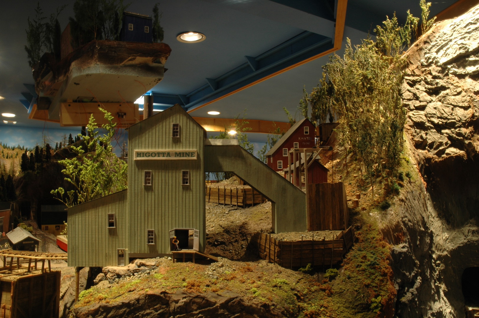
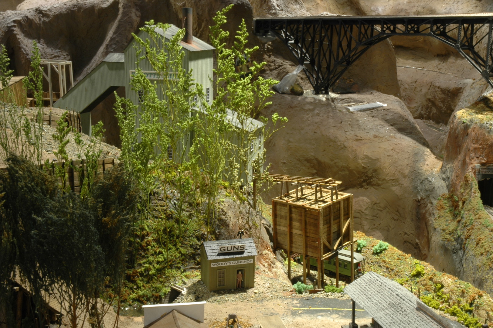
Photo 40 shows the other side of Higotta mine. The little green building in the center bottom of the photo is Woody’s Gun shop named in memory of Woody Matthews, longtime member of the 4D. That covers this area of the layout.
Next time we will finally have a look at Dry Gulch and all the changes that have occurred over the past few months. This entire area of the layout has been akin to assembling a large puzzle. There have been many “mini” scenes needing to be tied together. The last piece of the puzzle is Dry Gulch and its scenery. Most of Dry Gulch’s scenery had to be put on hold till all the other scenery was in place.
David
John Allen and John Olsen would be proud.
David, your scenery work is so fantastic. The detail and colors are very realistic and draw me into each scene. Love your work.